Regional Magnetic Field Calculator
This is a Regional Magnetic Field Calculator using the International Geomagnetic Reference Field Model.
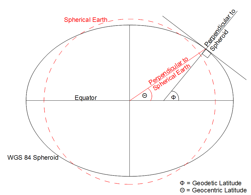
This takes the latitude, longitude, altitude and date to calculate the different components of the Earth’s Magnetic Field at that time and place. Note that these values do not take into account the geology of the area. The products from the model are shown in the table below and the two dials show the inclination and declination values. The type of latitude for the model can be changed between Geodetic and Geocentric and the definitions of these can be seen in the diagram. Note that for a Geodetic system the altitude is defined as the height above the WGS 84 Spheroid, and as the radial distance from the centre of the Earth for a Geocentric system.
More information on the International Geomagnetic Reference Field.
This includes the original FORTRAN code written by the IAGA Working Group V-MOD and the current IGRF coefficients which are valid for dates between 1900 and 2020. Dates up to 2025 will be calculated but reduced in accuracy. Acknowledgements to Dr Susan Macmillan at the BGS for the help implementing the IGRF code.
Magnetic Field Calculator
Set Parameters
| Value | Change/year | |
|---|---|---|
| Magnetic Field Inclination | ||
| Magnetic Field Declination | ||
| North Component (+N/-S) | ||
| East Component (+E/-W) | ||
| Vertical Component (+Down/-Up) | ||
| Horizontal Intensity | ||
| Regional Field |