EM38MK2
from Geonics
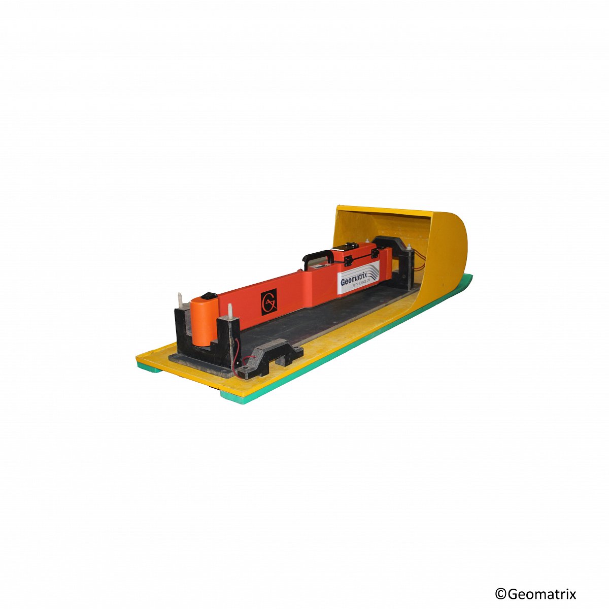
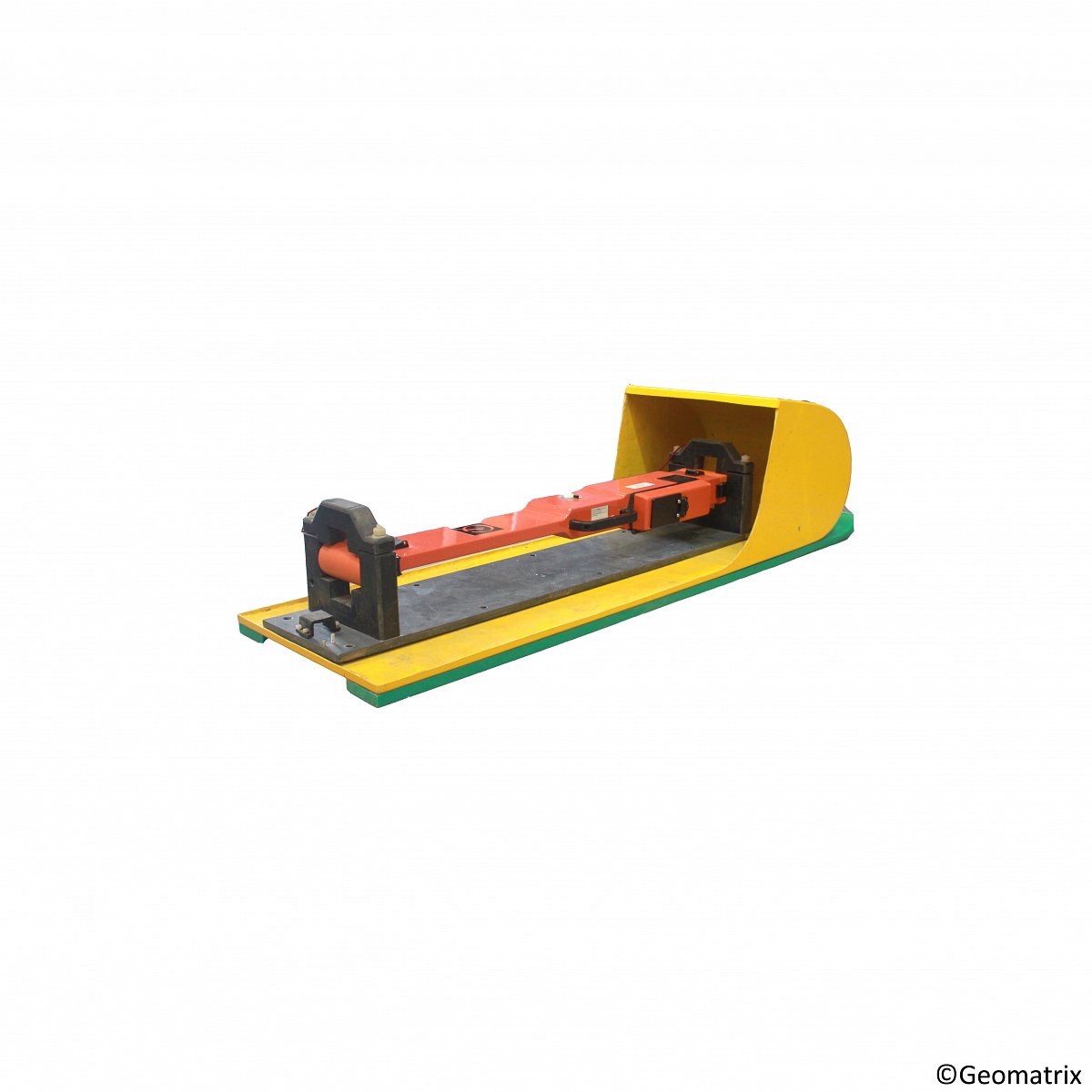
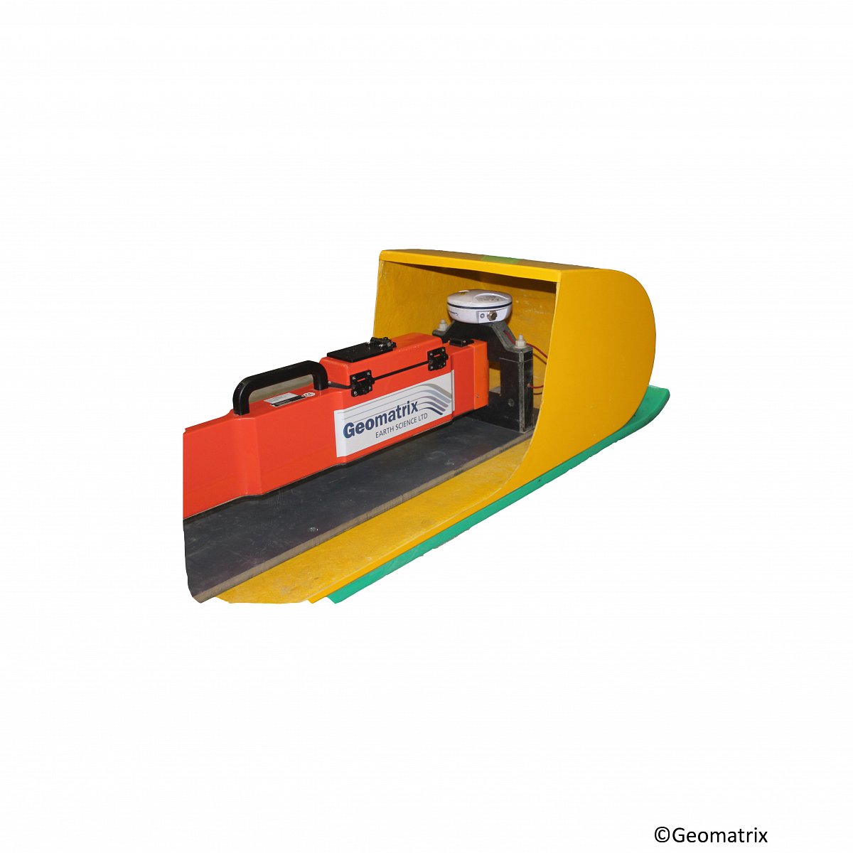
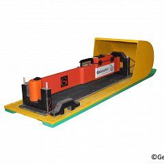
The EM38-MK2 Conductivity Meter measures both quadrature-phase (conductivity) and in-phase (susceptibility) components with two receiver coils. This instrument is perfectly suited for shallow monitoring of ground water pollution, mapping saline intrusions, mapping buried foundations and determining topsoil thickness.
The instrument includes two receiver coils, each orientated with vertical dipoles, separated by 1m and 0.5m from the transmitter, offering two effective depth ranges. It is also possible to operate the instrument on its side (horizontal dipoles) changing the effective depth ranges.
The EM38MK2 is designed to be particularly useful for agricultural surveys measuring soil salinity, and can cover large areas quickly without needing grounded electrodes.
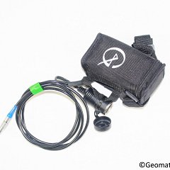
Very lightweight and only one metre long, the EM38MK2 provides rapid surveys with excellent lateral resolution. The instrument offers data transmission to a field computer via Bluetooth (10m range) allowing more flexibility during data collection. Data can be positioned by connecting a GPS receiver to the Messa2 data logger.
New coil technology, supported by temperature compensation circuitry, markedly improves temperature–related drift.
An optional, collapsible calibration stand supports automation of the instrument calibration.

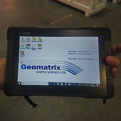
Measurements are recorded onto an Messa 2 ultra-rugged Windows 10 tablet via RS232 or Bluetooth. The EM38MK2 is supplied with data acquisition software call Data38MK2, alternative there are a number of other software packages which support the EM38MK2, which include Geomar Nav38MK2, RTmap38MK2 and Trimble FarmWorks.

Product Dimensions
| Physical | Dimensions (L x W x H) | Weight |
|---|---|---|
| EM38MK2 (instrument only) | 107cm x 17cm x 8cm | 5.4kg |
Technical Specifications
| Conductivity Ranges: | 0 to 1000 mS/m (4 digit digital meter) |
|---|---|
| In-phase ranges: | ±28ppt for 1m separation. ±7ppt for 0.5m separation. |
| Measurement Precision: | ±0.1% of full scale. |
| Power Supply: | 9V Alkaline battery for 5 hours operation or external 9-12VDC battery for 12 hours operation. |
| Inter-coil Spacing: | 1 & 0.5m for Em³8-MK2 1m for EM38-MK2-1 |
| Communication: | RS232 or Bluetooth 1.2 wireless |
| Temperature Range: | -30° to +50°C. |
Shipping
| Contents | Dimensions (L x W x H) | Weight |
|---|---|---|
|
Case1
EM38MK2 with ground carry handle and datalogger |
114cm x 30cm x 28cm | 22kg |
Data Sheet
- EM38MK2 Datasheet (PDF)
Literature
- TN-36 Mag Sus of soils is complex (PDF 4MB)
- TN35 Archaeology mapping using EM38 (PDF 3MB)
Checklists
- Checklist for Data Storage and Transfer (PDF 249KB)
- Checklist for Data Processing (PDF 190KB)
- Checklist for Field Editing (PDF 244KB)
- Checklist for GPS Operating Procedures (PDF 231KB)
- Checklist for Instrument Storage (PDF 138KB)
- Checklist for Out of Box Equipment Tests (PDF 228KB)