Mini Raptor
from ImpulseRadar
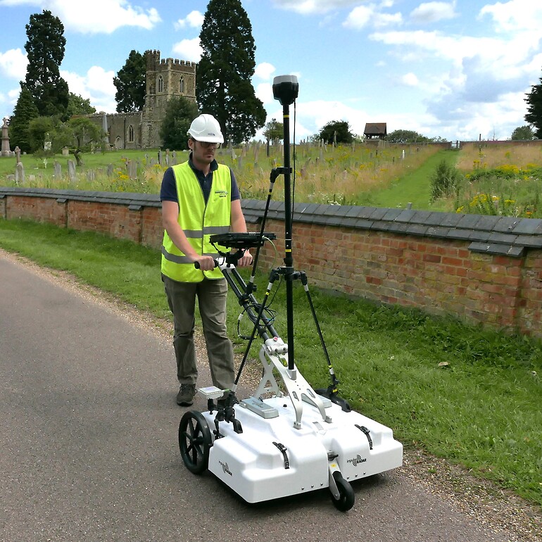
The Raptor 45 cart (Fig. 1.) is a manual and robust, high speed 3D Ground Penetrating Radar system (GPR) optimal for surveys which require detailed shallow near surface investigation and fast acquisition in enclosed areas. Typically you can reach an imaging depth up to 5m under good ground conditions in well drained, sandy loam soils in the UK. The system can be used on hard standing/ concrete, short grassy fields and flat land free of debris. As part of the raptor series of GPR systems, the instrument uses real time sampling (RTS) technology to obtain accurate and fast results for a variety of applications.

The cart configuration can be used as an 8 channel arrangement with a width of 0.9m for the 450MHz antenna and up to a 12 channel array for the 800MHz antenna. It will depend on the scale of the object(s) the user is looking to image and the resolution they require as to which antenna should be used. The lower frequency 450MHz antenna will allow the user to image till 5m depth, example applications would be archaeological, civil structure utility and railway mapping. A more detailed scan of the upper surface of ground can be obtained with the 800MHZ antenna reaching maximum 2m depth (UK) this antenna is typically used to image roadbed layers, concrete scanning and where applicable large tree root structures.
The 450MHz antenna themselves can be removed and added to the vehicle raptor 18ch mount for ease of use so that the user can interchange between a cart survey setup or a large vehicle array for large area surveying, road, field or airfield surveys, this is also applicable for the 800MHZ antenna which can interchange to a 28ch vehicle mount system.
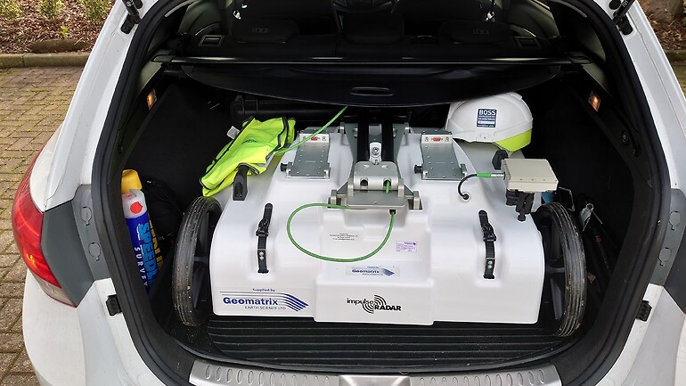
It can easily be set up, with a foldable handle, a fitted mounting bracket near the front of the wheel which allows a quick change of a 150mm or 300mm guidance wheel and adjustable straps near the front and back of the cart to change the antenna height off the ground. The raptor cart can easily be constructed, transported and stored by one person for use on a number of project sites especially in constricted areas; please see the image below of the cart ready for transport in the boot of a standard car (Fig.2)

In terms of the data collection, the data acquired over each survey line can be combined with DGPS data improving the accuracy and gathering process. The system has its own internal GPS system which has 1cm accuracy although for more accurate precision the system can be used with a standard external DGPS system or your own external RTK system which outputs the GGA NEMA string. Furthermore, its modular design allows the user to to make their own channel arrangement (from 4ch to 30ch) depending on their requirements.
The data acquired using the Talon II acquisition software can be stored on your windows tablet and transferred using a standard USB device. The output files are in .Irp format with the separate files including .gps, .time. The user can use any compatible software, however the Condor software has been specifically designed to handle this 3D data and interpolate the X,Y,Z data and any features in osprey view. After interpreting the data, this can easily be exported to a CAD readable format.
Features
- Fast data collection at 130km/hr, 5cm point interval
- High Dynamic range and deep penetration
- Small Point interval and rapid data collection regardless of the n.o channels
- Low Weight
- Flexible, modular and plug and play configuration of antennas, no control unit
Product Dimensions
| Physical | Dimensions (L x W x H) | Weight |
|---|---|---|
| Mini Raptor (instrument only) | 900 mm x 700 mm x 250 mm | 42kg (450mhz) or 36kg (800mhz) |
Technical Specifications
| Antenna Center Frequency: | 450MHz or 800MHz |
|---|---|
| Antenna Footprint: | 165 x 230 mm or 110 x 150 mm |
| Antenna Weight: | 1.86 kg or 0.95 kg |
| N.o Channels: | 8 or 12 |
| Scan Width: | 580 mm / 600 mm |
| Cart weight and Dimensions: | 42 kg; 900 x 700 x 250 mm or 36kg; 900 x 700 x 250 mm |
| Power Consumption: | 48 W or 72 W |
| Maximum System Configuration: | 30 Channels |
| Environmental Rating: | IP 65 |
Shipping
| Contents | Dimensions (L x W x H) | Weight |
|---|---|---|
| Mini Raptor - Cart (450MHz) | 950 mm x 920 mm x 550 mm | 90kg |
| Mini Raptor - Cart (800MHz) | 950 mm x 920 mm x 550 mm | 110kg |
Data Sheet
- Mini Raptor Datasheet (PDF)


