CleanSweep
from Oceanic Imaging Consultants
CleanSweep provides a powerful processing platform for hydrographic survey data management, processing and analysis. With an intuitive user interface and project orientated architecture, multiple datasets can be imported within a project and processed alongside one another for enhanced efficiency. Multibeam, Side Scan, Forward Look and Interferometric datasets can all be processing in one work space.
Fast : Intuitive : Powerful : Flexible
CleanSweep will automatically locate charts and satellite imagery using the GlobalMapper service and display them as a background overlay in the navigation pane. Navigation errors can be located with cross reference to, heading, pitch, roll and heave records to ensure complete data fidelity. Advanced dead reckoning correction algorithms are included within CleanSweep for surveys preformed by UAVs.
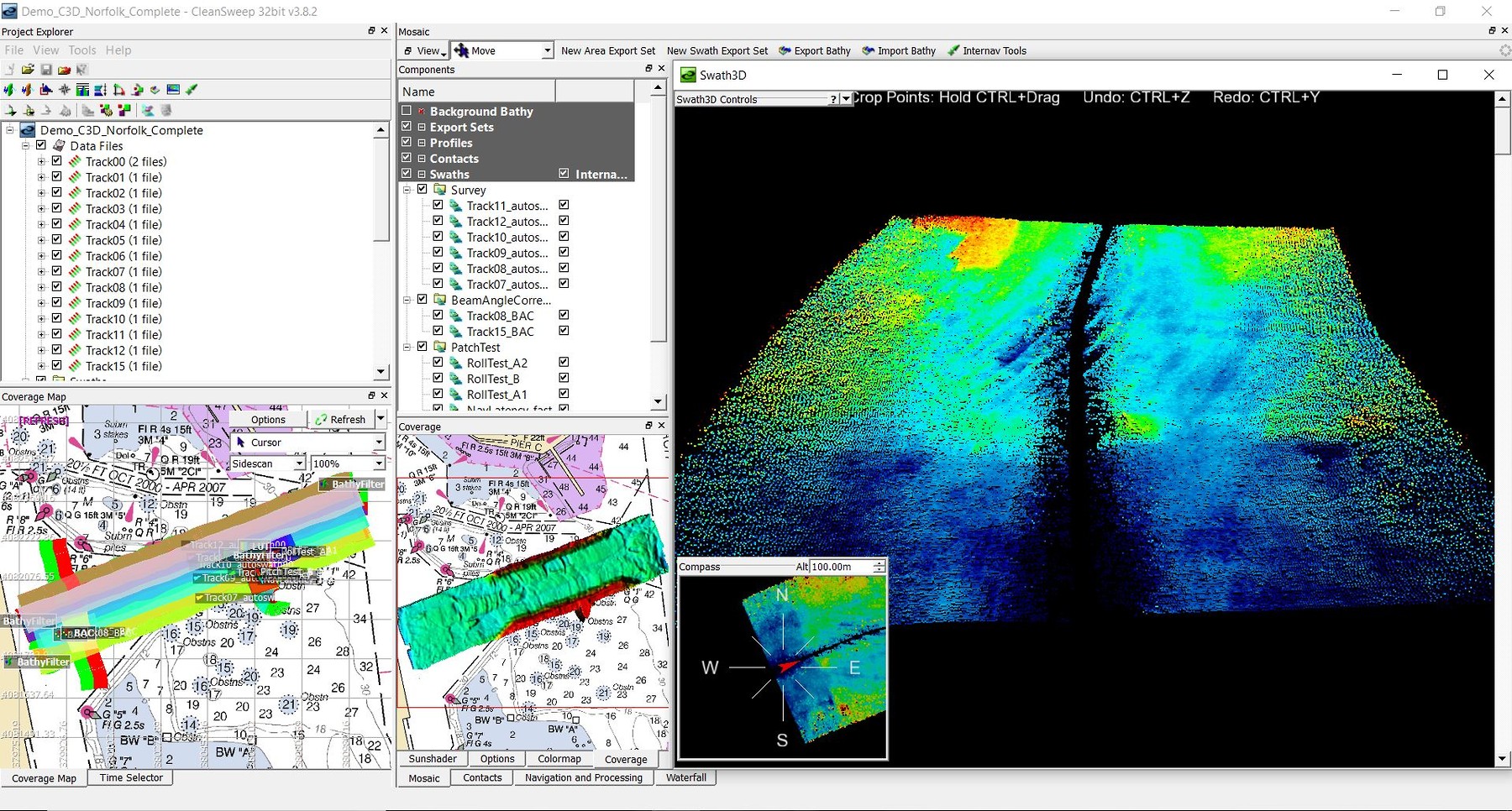
Graphical User Interface
The user interface is centred around a simple directory tree structure, files can be selected by checking them on and off like layers in a GIS package. Data visualisation and processing tool bars are presented in the form of multiple window pains which can be quickly navigated through by selecting the appropriate tabs. Mouse movements are tracked across all windows allowing the users to identify targets or apply corrections via waterfall or mosaic.
Navigation & Attitude Processing
With a full suit of navigation and attitude processing tools operators have complete control over all project data and metadata. Both the positional and metadata can be visualised in different graphical displays to assist positional quality control and positional corrections can be refined or recalculated in the instance that sensor offsets were not applied correctly at the time of data acquisition. Third party sensor information can also be utilised to constrain and improve attitude errors.
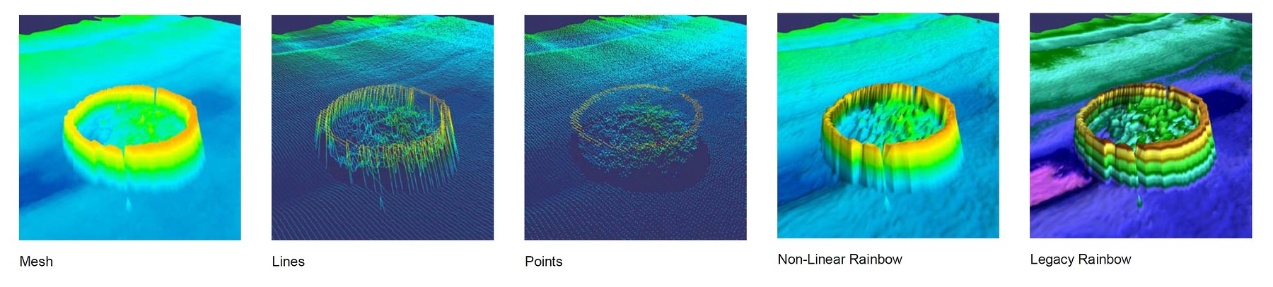
Data Processing Tools
CleanSweep includes all of the fundamental processing tools one would expect for Multi-beam and Sonar. It also incorporates a number of tools which are designed from the perspective of a data processor which aid save time and allow the user to utilise and constrain processing using third party datasets, for example Sid Scan Sonar bottom tracking can be automatically derived from Multi beam data if the two datasets have a common time stamp.
Feature Based Navigation
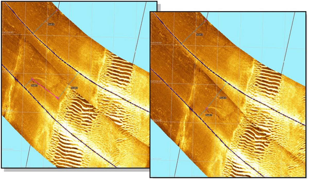
CleanSweep’s InterNAV tools allow users to interactively adjust navigation by identifying/matching features in overlapping swaths or using features with known positions. What makes InterNAV unique is its adoption of a SLAM-derived algorithm which recomputes trackline navigation rather than simply georectifying the swath, transforming a simple interactive task into a powerful Navigation correction tool. it is particularly useful when processing deep tow Side Scan systems or AUV based imagery systems where precise position of the sensor is not always possible.
Technical Specifications
| Operating system: | Windows 32 or 64 bit |
|---|---|
| Import Options: | C-Max (.cm²), EdgeTech (.jsf, .sas), GeoDAS ( PingDSP (.oic), R2Sonic (.r2s) (.oic), ProSAS ( img), GeoSwath (.rdf, .rff), Hypack (.hsx) ( dat), Raytheon AST (.Reson 7k Series (.s7k), Reson PDS2000 (.pds), Isis Raw (.SeaBeam ( xse), Imagenex (.81s, .872, .83p, .d1p), Klein (.sdf), Kongsberg/Simrad ( all smb (.SwathPlus (.sxi), Teledyne Odom (.tdy), (.all, .smb, .raw), Tritech StarFish ( logdoc), Marine Electronics (.ifm), Marine Sonic Tech (.mst, .sds), (.Triton (.xtf) |
| Export Options: | ASCII xyz, llZ, GeoTIFF 8/24 bit, GRD grid, ESRI grid, ESRI geodatabase, OIC grid, printer ready PostScript, Generic Sensor Format, etc. |
Data Sheet
- CleanSweep Datasheet (PDF)
Videos
-
http://www.oicinc.com/res/videos/Gavia_GS+_Demo_Part_1_Start-to-Waterfall_x264.mp4
(Duration - http://www.oicinc.com/res/videos/Gavia_GS+_Demo_Part_1_Start-to-Waterfall_x264.mp4) -
http://www.oicinc.com/res/videos/Gavia_GS+_Demo_Part_2_processing_x264.mp4
(Duration - http://www.oicinc.com/res/videos/Gavia_GS+_Demo_Part_2_processing_x264.mp4) -
http://www.oicinc.com/res/videos/Gavia_GS+_Demo_Part_3_Mosaic-to-Export_x264.mp4
(Duration - http://www.oicinc.com/res/videos/Gavia_GS+_Demo_Part_3_Mosaic-to-Export_x264.mp4)