EM38-4
from Geonics
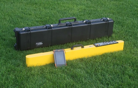
Building upon the established electronics, functionality, and interface of the EM38MK2, the EM38-4 offers enhanced subsurface investigation capabilities. While retaining the ability to acquire In-phase (Magnetic Susceptibility) and Quadrature phase (Conductivity) measurements, the EM38-4 features two additional receiver coils. This expansion allows for the acquisition of data at up to eight distinct depths, doubling the four depths offered by its predecessor. The increased data from the four receiver coils facilitates a more detailed understanding of the soil profile through advanced processing techniques such as 2D and 3D layer inversion modelling. Bluetooth connectivity enables seamless real-time data transmission to loggers or tablets within a 10m range, with support for external GNSS integration. The system’s versatility allows for deployment in various configurations, including handheld operation, vehicle towing, or vehicle/sledge mounting for continuous data acquisition. The EM38-4 achieves a maximum simultaneous prospection depth of 1.5m in the vertical coil orientation, with a shallower reach of 0.75m available in the horizontal dipole configuration, ideally suited to characterising and managing agricultural soils.

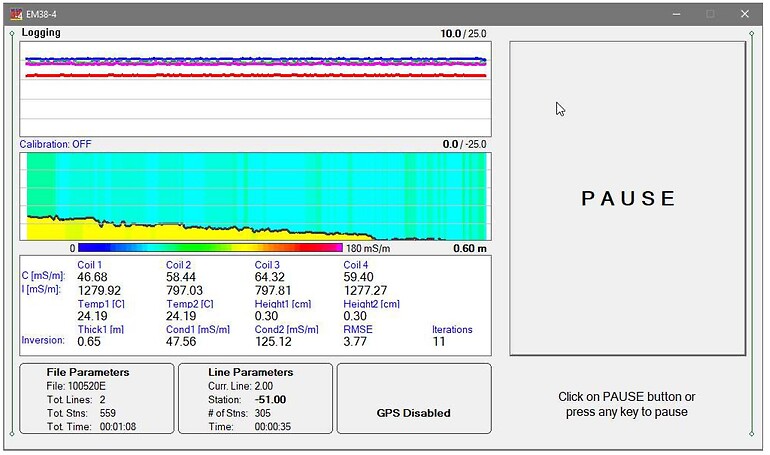
The data acquisition software integrates a dynamic, real-time 2D layered model view. This intuitive visualization immediately translates the sensor readings into a cross-sectional representation of the subsurface, allowing users to quickly and easily delineate the depth and variability of the topsoil layer as data is being collected.

Product Dimensions
| Physical | Dimensions (L x W x H) | Weight |
|---|---|---|
| EM38-4 (instrument only) | 133cm x 17cm x 8cm | 9kg |
Technical Specifications
| Intercoil Spacing: | 0.5,0.75,0.88 and 1m |
|---|---|
| In-Phase Range: | +/- 28 ppt for 1m separation +/- 22 ppt for 0.88m separation +/- 16 ppt for 0.75m separation +/- 7 ppt for 0.50m separation |
| Measurement Precision: | +/- 0.1% of full scale |
| Measurement Accuracy: | +/- 5% of full scale |
| Noise Level: | +/- 0.5mS/m (Conductivity) at 1m separation +/- 0.02 ppt (In-Phase) at 1m separation |
| Operating Frequency: | 14.5kHz |
| Data Communication: | Rs232, Bluetooth, USB |
| Temperature Range: | -40-50 Degrees C |
| Power Source: | External 12VDC Rechargeable battery |
Shipping
| Contents | Dimensions (L x W x H) | Weight |
|---|---|---|
|
Case1
EM38-4 |
140cm x 25cm x 15cm | 20kg |
Data Sheet
- EM38-4 Datasheet (PDF)
