PinPointR
from ImpulseRadar
A compact and robust high frequency GPR system which has been specifically designed to meet the requirements of the utility detection industry. The PinPointR GPR system combines Impulse Radar’s real-time sampling (RTS) technology with a dual set of antenna to provide unquestionable data fidelity and resolution.
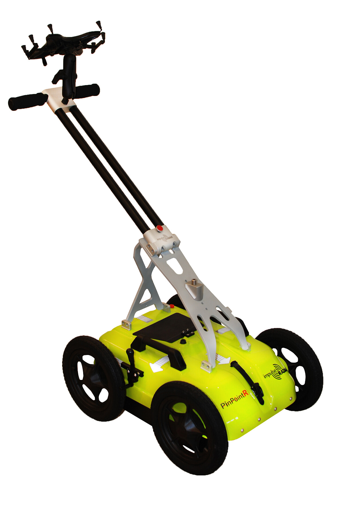
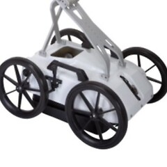
As a Dual frequency system, the PinpointR (Fig.1) allows the user to collect simultaneous data at two depth ranges using the 400MHz and 800MHz antenna and targets picked from either channel on the fly. Under good ground conditions (well drained sandy loam soil) the user can image around 2m and 5m below the ground surface; picking up on features such as electric, water mains, gas pipes and other common utilities found within this depth range. The system can help the user detect, locate and track one or more features beneath the surface and plot the results up on a map; swaths can be collected in an X, Y grid format or as single lines. As with all GPR systems it is difficult to distinguish the type of utility being detected, therefore the system must use other information (e.g. previous known data/ estimated depth of a utility) gathered from the area to aid data interpretation
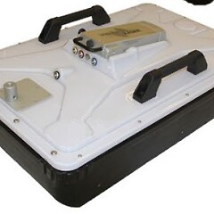
The compact all-in-one design means the system can be stored and transported complete, so that it is ready for use at a moment’s notice. Easily packed within the boot of a car, it’s a relatively lightweight system, which has a handle which folds out ready for you to start acquisition. Powered using a single Li Ion battery the system communicates via WIFI to any android device (phone, tablet) which has the Viewpoint acquision software installed (freely available). The operator then can choose between single acquisition or multi line acquisition mode (Fig.2.), select the depth window and set to internal or external GPS mode. If a more accurate position is required (e.g. RTK FIX 4), any RTK system running a GGA NEMA sentence can communicate with the PinpointR.
The data exported can be interpreted and processed in GPR-Slice or the Crosspoint software before being exported in a CAD readable format.

Features
- Simultaneous Dual frequency data acquisition (400MHz & 800MHz)
- Lower power consumption permitting 7 hours operation off one charge
- Easy to use Android interface
- Wireless coms with recording device
- Data back-up, Internal SD memory to ensure no data is lost during wireless transfer.
- Internal GNSS for accurate data timestamping and basic Geo-referencing
- Fully integrated support for external RTK GNSS
- Automatic Utility report generation
Product Dimensions
| Physical | Dimensions (L x W x H) | Weight |
|---|---|---|
| PinPointR (instrument only) | 101cm x 54cm x 103cm | 20kg |
Technical Specifications
| Channels: | 2 |
|---|---|
| Centre frequency: | CH-1: 400 MHz / CH-2: 800 MHz |
| Record Length: | Max 400ns |
| Bandwidth: | >120%, fractional, -10 dB |
| Digitisation: | 16-bits (default), 32-bit (optional) |
| Survey speed: | > 130 km/h @ 5 cm point interval |
| Scan rate: | >800 Scans per second |
| Acquisition mode: | Wheel, time or manual |
| Positioning: | Wheel encoder, internal DGPS, external GPS (NMEA 0183 protocol) |
| Power supply: | 12 V Li-Ion rechargeable battery, or ext. 12 V DC source |
| Power consumption: | 1.26 A |
| Operating time: | 7 hours |
| Operating temperature: | -20° to +50°C |
| Environmental: | IP65 |
| Regulatory certification: | CE, FCC, and IC Approved |
Shipping
| Contents | Dimensions (L x W x H) | Weight |
|---|---|---|
|
Case1
PinPointR GPR System with GNSS tripod |
95cm x 60cm x 40cm | 30kg |
Data Sheet
- PinPointR Datasheet (PDF)

Application Notes
Data Enhancement Tools
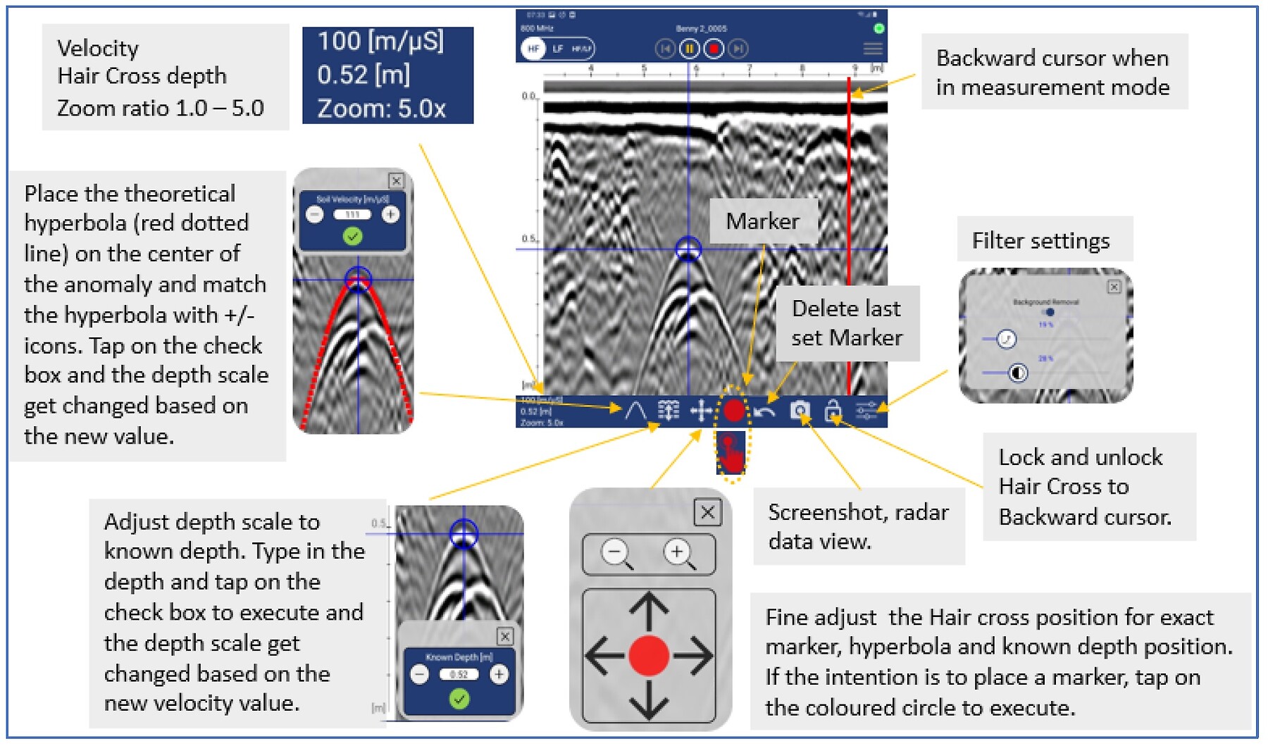
ViewPoint data aquitions software is easy to use with interactive data processing tools to assist enhance anomalies for interoperation on the fly.
Georeferencing on the Fly
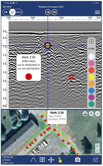
ViewPoint permits operators to pull in aerial imagery and view marked features on the fly. When leaving a project the user will be prompted to generate a PDF Field Summary report and a KMZ files.
Local Grid Project
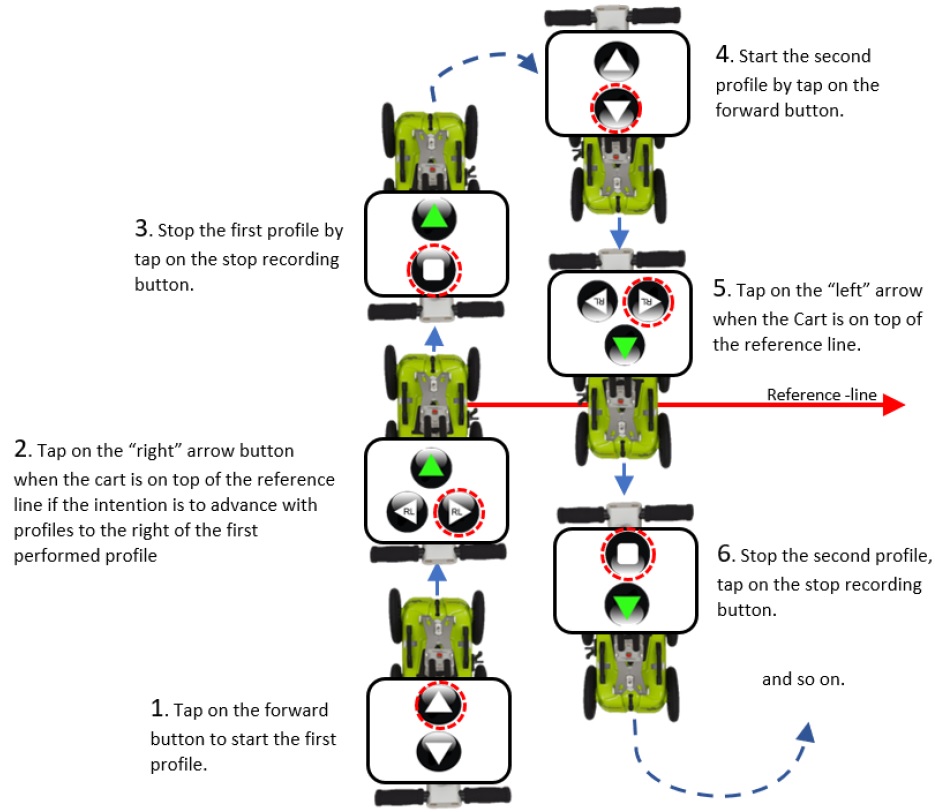
The RL-project associates and orientates GPR profiles to a straight-line reference. This reference line can be any type of physical line visible within the survey area during and after data collection. Examples include boundaries, curb lines, fence lines, or merely a metering-tape laid on the ground. Regardless, one end of the line needs to be defined as the starting point and then equidistant points marked along its length. Profiles are gathered in straight lines, perpendicular to the reference line, and a reference-marker is placed within the GPR data every time the reference line is crossed.
FAQ's
How do I download my ImpulseRadar Viewpoint files from my Android device?
In August 2022, Android released version 13 of their operating system. New data security measures restrict access to folders/files apps can open from the device memory, this includes the file explorer app supplied with the Android installation. Single Line and Multi Line Project folders can exported through the VeiwPoint application.
1) Open the ViewPoint App 2) Press the [Folder] icon 3) Navigate to the Single or Multi line project folder to be downloaded 4) Press and hold on the project folder until the sub menu opens with the options Send, Zip and Delete. 5) Zip the project folder 6) Press and hold on the Zipped project folder until the sub menu opens. 7) Press [Send] 8) Choose the path you want to send the Zipped folder to. this could be an Expernal USD memory drive or cloud storage.