SAMM
from Oceanic Imaging Consultants
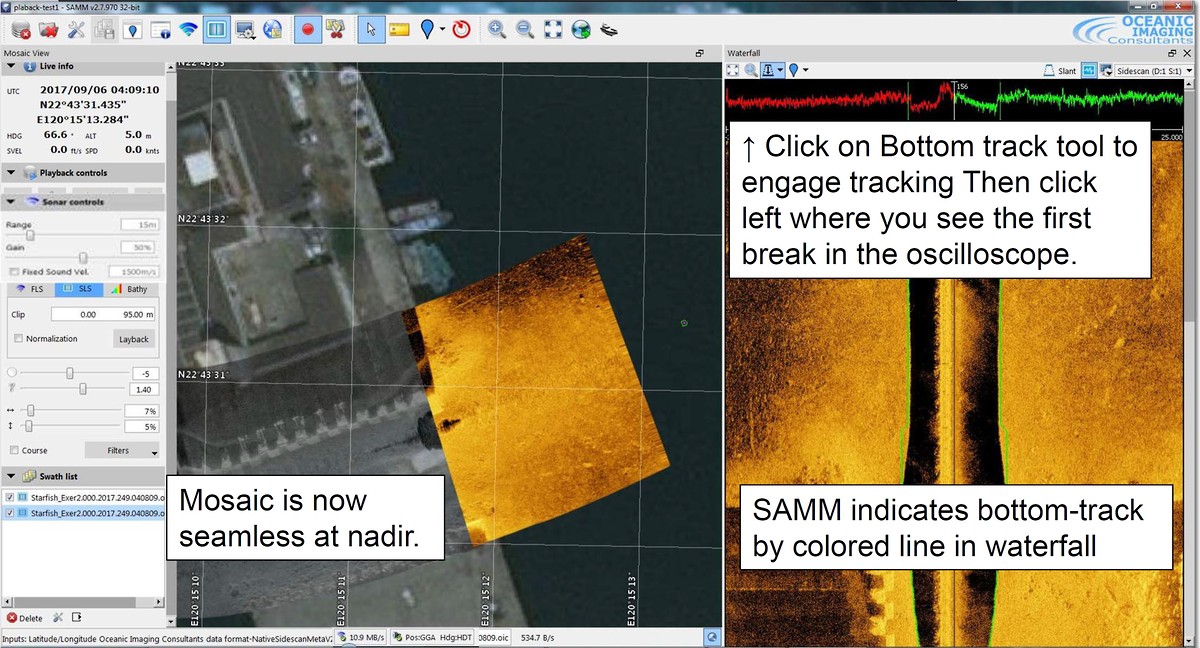
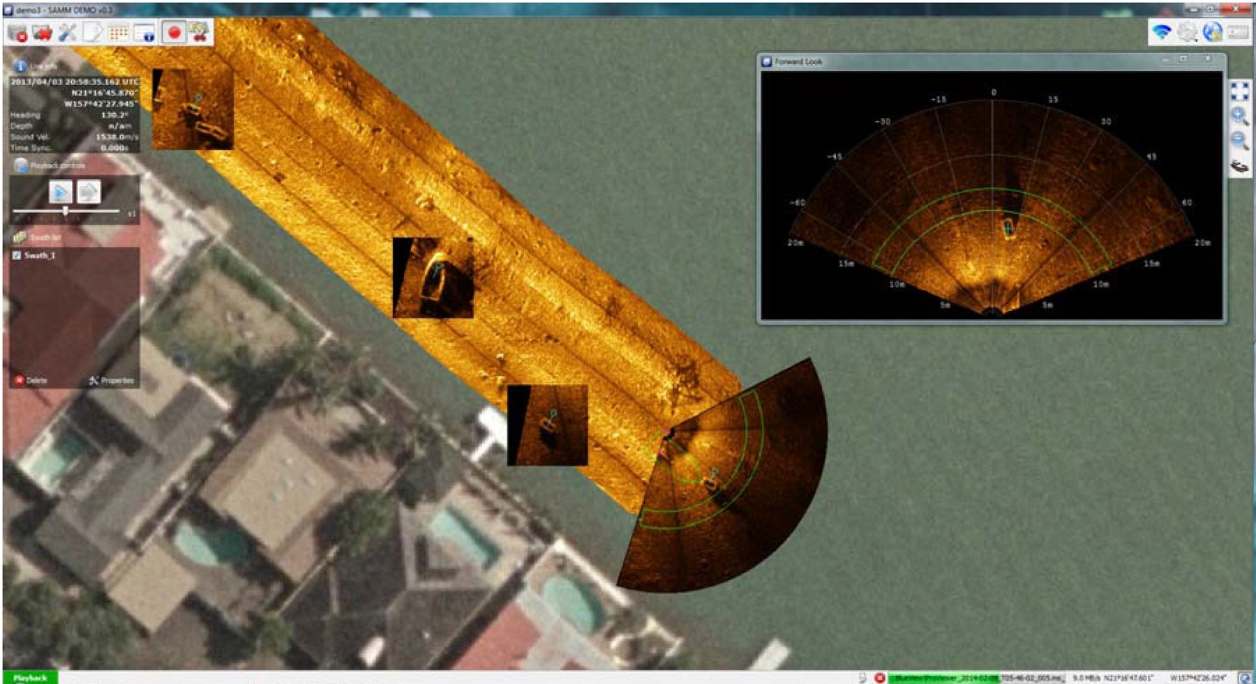
SAMM is a Stand Alone Mosaicking Module designed to run alongside existing manufacturers data acquisition programs to enhance survey capability by proving real-time mosaicking, georeferenced charts, satellite imagery overlays and geo-coded observation classification. Compatible with leading Multibeam Forward Look sonars, Side Scan Sonars, Scanning Sonars and Multibeam Echo Sounders. SAMM connects to the instrument data feed providing seamless integration with leading instrumentation.
- Easy to Use Plug-and-Play Add-on to Your Forward Look Sonar, Side Scan Sonars
- Automatically Creates Mosaics in Real Time from Forward Look Sonar Data
- Automatically Loads Background Charts or Imagery for Easy Geo-Referencing
- Supports Post-Processing, Swath Layering, Imagery Enhancement and Export
SAMM is an affordable plug-and-play software package that turns your sonar into a survey system, giving you real time mosaics and 100% confidence in your coverage.
Data Acquisition Features:
- Stand-alone module, seamlessly compatible with your existing FLS system
- Interactive control of track layering, processing and sensor offsets
- Simultaneous mosaicking and logging of broadcast data
- Pan, zoom, target marking and vessel track
New Feature:
- SAMM now supports real time bottom tracking for selected Side Scan Sonars.
- Pseudo ‘Single Beam’ bathymetry if the side scan is hull/poll mounted.
- Dual-Axis Scanning Sonar
After connecting to the instrument and configuring the navigation port, SAMM will automatically search the internet for local georectified charts and satellite images for use as a background layer.
Post-Acquisition Processing Features:
- Navigation and heading filtering
- Sensor/navigation offset and bias corrections
- Instant reprocessing and editing of recorded data
- Easy image export to GeoTIFF and Google Earth
- Per-track adjustment of contrast/gamma/brightness
- 16-bit imagery support for optimum image resolution
- Interactive image selection tools for cherry picking data
- Contact marking, measurement, classification and export
- Layering of individual tracks for optimal mosaic composition
- Background display of air photos, satellite imagery, raster and vector charts